Summary: An interdisciplinary team comprising researchers from the Universities of Innsbruck, Akron, Oxford, and Sheffield has recently returned from a successful expedition to a remote area of Northeast Greenland located at 80°N. The expedition, which was funded through an FWF Start Prize to Prof. Gina Moseley (Inst. Geology, Innsbruck), collected samples and undertook research into the region’s palaeoclimate and environment, geological history, former glacier extent, geomicrobiology, and entomology. The palaeoclimate research will be used to improve understanding of how this region, which is highly sensitive to climate change, responds in a warmer and wetter world. The palaeoglaciology team collected 22 rock samples that, combined with contextual geomorphological mapping from the ArcticDEM, will provide information about the timing of ice sheet recession and thinning in this little-studied, yet important region. Additionally, samples were collected to help understand a more ancient glacial event at the Ordovician-Silurian boundary, 445 million years ago. Whilst in Greenland, the team documented and explored over 30 caves that had never previously been visited. In doing so, they broke their own records for the longest explored cave in Greenland and the most northerly explored cave on the planet. Several samples were collected from the caves for geomicrobiology to determine the mechanism that allows microbial survival in these cold and dry caves, and the role that these species may play in the formation of unusual cave formations.


The Greenland Caves Project is primarily a climate change research project, which also contains elements of adventure and exploration. In the 1960s, during the cold war, the US army worked in Northeast Greenland looking for places to land aircraft in an emergency. Subsequently, in the 1990s, the Geological Survey of Denmark & Greenland carried out the geological mapping of the region. During those explorations, several caves were discovered at 80°N in Kronprins Christian Land. To the average cave explorer they were rather boring, as most were only a few metres long before they became blocked by ice and sediment; however, the report written in 1960 documented that one cave contained calcite deposits in the form of flowstone (like a stalagmite but forming a sheet rather than a candlestick). This information is crucially important because today the region is extremely arid (less than 200 mm per year of precipitation) and the ground is frozen, preventing the deposition of such calcite deposits under the current climatic regime (because they need water and unfrozen ground). The presence of these calcite deposits therefore tells us that at some point in the recent geological past, this area has been warmer and wetter then today. This is important because models of future climate predictions show that NE Greenland is one of the most sensitive areas of the world to climate change. In the future, the region is predicted to get warmer and wetter. The calcite deposits can be investigated to establish details of the climate characteristics and environment of this region in the past. To date, high-resolution climate records for Greenland have been retrieved from ice cores drilled through the interior of the Greenland ice sheet; however, these records are limited to the last 128,000 years, and there is little scope to go further back in time. The records obtained from calcite deposits in the caves provide the opportunity to extend the knowledge of Greenland’s past climate beyond the limits of the ice cores. Such information will prove vital for improving future climate predictions.

Project leader Prof. Gina Moseley, learned about these caves and recognised their importance back in 2008 whilst doing her Ph.D. in Bristol, UK. She sat on the information for a few years, and then in 2015 led a 5-person expedition crowdfunded by 59 different sponsors. This initial expedition involved flying as far as they could, inflating a boat, crossing a 20 km wide lake, and then hiking for three days to get to the caves. It was a real adventure. The team spent three days at the caves exploring as much as they could. They discovered 26 caves (more than the original 11 that were reported in 1960). They discovered a note written by the original explorers and far more extensive calcite deposits in these caves than they had imagined (the original paper only mentioned one sequence 4 inches thick). Unfortunately due to the team being on foot and without helicopter support, it was not possible to sample as much as they wanted, and so they took enough material for pilot analyses (16 samples). Gina has spent the last few years working on these deposits; many samples were too old to date with standard methods (over 650,000 years), or altered chemically, but a few contained good-quality climate records that proved the concept of climate reconstructions from cave deposits in Northeast Greenland. This is the first time that such climate records have been constructed from caves in the High Arctic. Using this data, Gina was able to successfully win one of Austria’s most prestigious research prizes (a 1.2 million euro FWF Start grant). At the start of 2019, the 6-year project began.


During July, 2019, the Greenland Caves Project returned to Northeast Greenland for a three week expedition. This time, with more financial support, they were able to achieve everything Gina had hoped for and more. Given the high cost and difficult logistics, Gina wanted to maximise scientific potential. She therefore invited along a number of other scientists that would complement the palaeoclimate work. The team included Prof. Hazel Barton, a cave geomicrobiologist from the University of Akron; Prof. Paul Smith, Director of the Oxford University Museum of Natural History with years of geological mapping experience in the region; Dr. Andrew Sole from the University of Sheffield, a glaciologist with particular expertise in the impacts of climate change on contemporary Greenland Ice Sheet processes; Dr. Ádam Ignéczi, also from the University of Sheffield, with expertise in glacial geomorphology, and Greenland ice sheet surface and bed topography; and Paul Töchterle, a Ph.D. student from the University of Innsbruck with expertise in permafrost studies from caves. Additionally, the support team included medic Dr. Pete Hodkinson; photographer Robbie Shone; safety and rigging expert, Chris Blakeley, who works for Petzl; helicopter pilot Stig Erick Bjerkenås; and mechanic Hans Christian Sivertsen. Together, the team comprised seven nationalities in a truly interdisciplinary expedition.


The main objectives of the expedition were to: (1) collect samples of cave calcite for use in palaeoclimate reconstruction; (2) measure sedimentary sections across the Ordovician – Silurian boundary and collect stable isotope samples to improve our understanding of the end-Ordovician glaciation and extinction event, 445 million years ago; (3) improve the detailed geological mapping around the caves to elucidate the speleogenetic constraints; (4) investigate the former ice sheet extent through dating of glacial erratics and eroded bedrock; (5) investigate the microbiology of the caves; (6) undertake an entomology study; (7) survey the larger caves using the latest digital techniques, including photogrammetry; (8) explore the area for previously undiscovered caves and investigate and map them where found. Whilst in the area, entomology samples were collected for study at the Oxford museum and samples were also collected for the POP Greenland project, which aims to look at persistent organic pollutants reaching Greenland, while several members of the expedition took part in a study for NASA/University of Manchester examining the psychology of expeditions in remote locations.


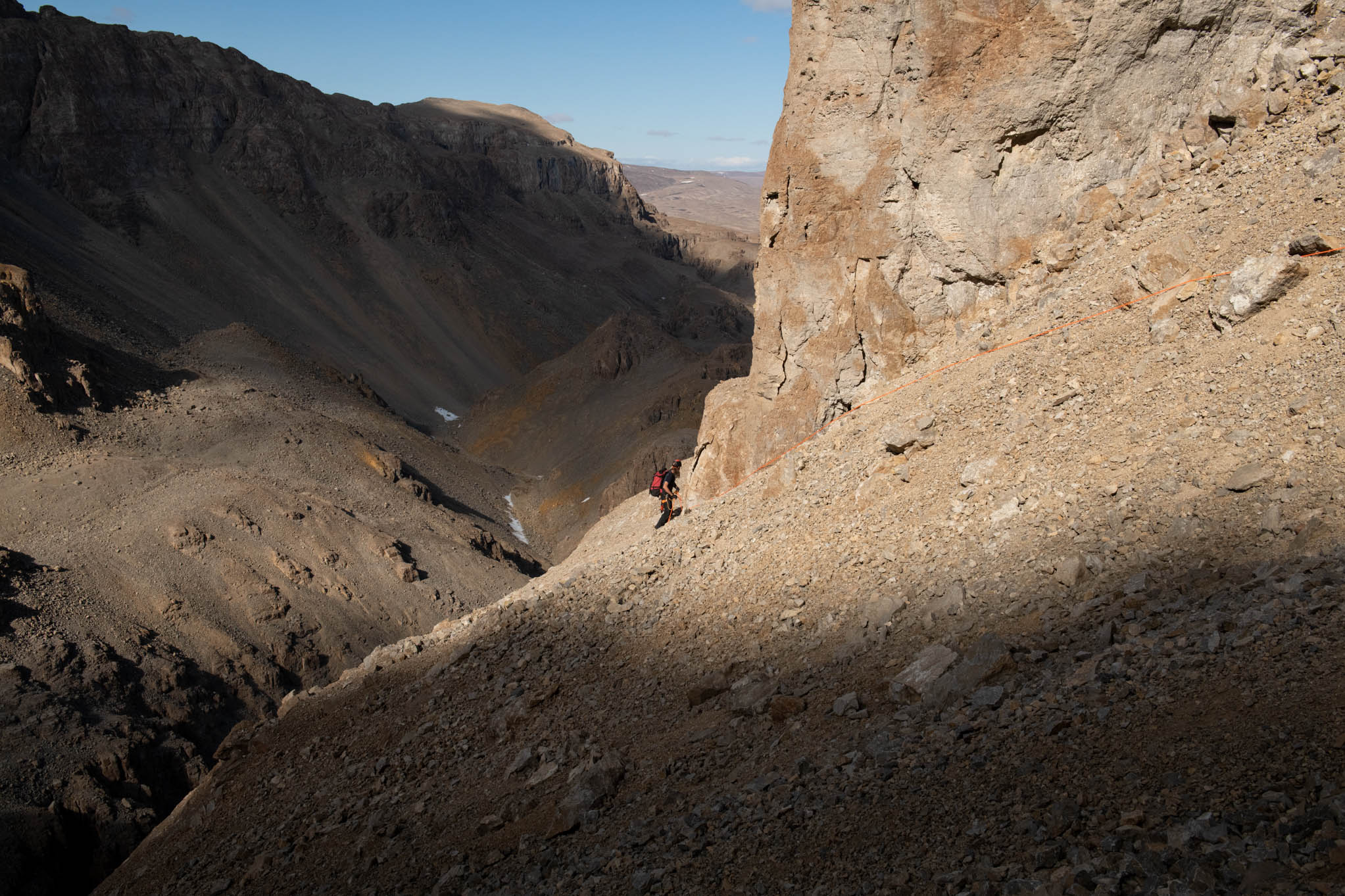
The expedition worked from three base camps. Accessing some of the caves was difficult, involving taking two steps forward and one step back up steep scree slopes and traversing highly-exposed ledges. Disappointingly, after four years of dreaming and thinking about how to collect a sample from the primary target, the calcite turned out to be too difficult to work with and completely disintegrated during sampling. It could have put an end to the entire project; however, the team were able to find many other, better-quality calcite sequences that were suitable for sampling. For the first time in Greenland caves, stalagmites (rather than flowstones) were also observed. The majority of samples that were collected were already naturally broken, but often required coring or grinding into manageable-size pieces.


Beyond examining the microbiology of the glaciers, very little microbiology has been carried out in Greenland, with no description of any microbiology in the caves. The goals of the microbiology and geomicrobiology were to better understand the microbial ecology of these previously unexplored environments, and to establish whether the extremely isolated and cold conditions drove microbial resource competition, with the potential for secondary metabolite production. Within the caves, there was little evidence of microbial activity, presumably due to their cold and dry conditions. Samples were taken of what appeared to be calcifying microbial communities seen in the entrances of several caves, along with the floor sediments. These samples were returned safely to the lab and Hazel’s team will begin the time-consuming process of trying to identify the microbes present. Hazel also identified some unusual minerology in these caves, which may be related to the dry and freezing conditions within these caves. These included potentially two new types of cave formation: 1) a brown mineral near the entrance of Cairn Climb Cave; and 2) tiny, needle-like speleothems that resemble frostwork seen in all the caves.
Another unusual discovery was the identification of phytokarst in these caves. Phytokarst is an erosion of the cave rock by photosynthetic microorganisms. Because this activity is dependent on light, it is only found in cave entrances and results in the formation of pinnacles of rock that point toward the entrance. Previously it had only been identified in tropical cave environments, like Borneo, and was thought to require high humidity and lots of organic energy from jungle soils to drive the process. The discovery of phytokarst in these cold, dry Greenlandic caves that receive no sunlight for a large portion of the year suggests that everything we thought we knew about the formation of phytokarst is probably wrong.


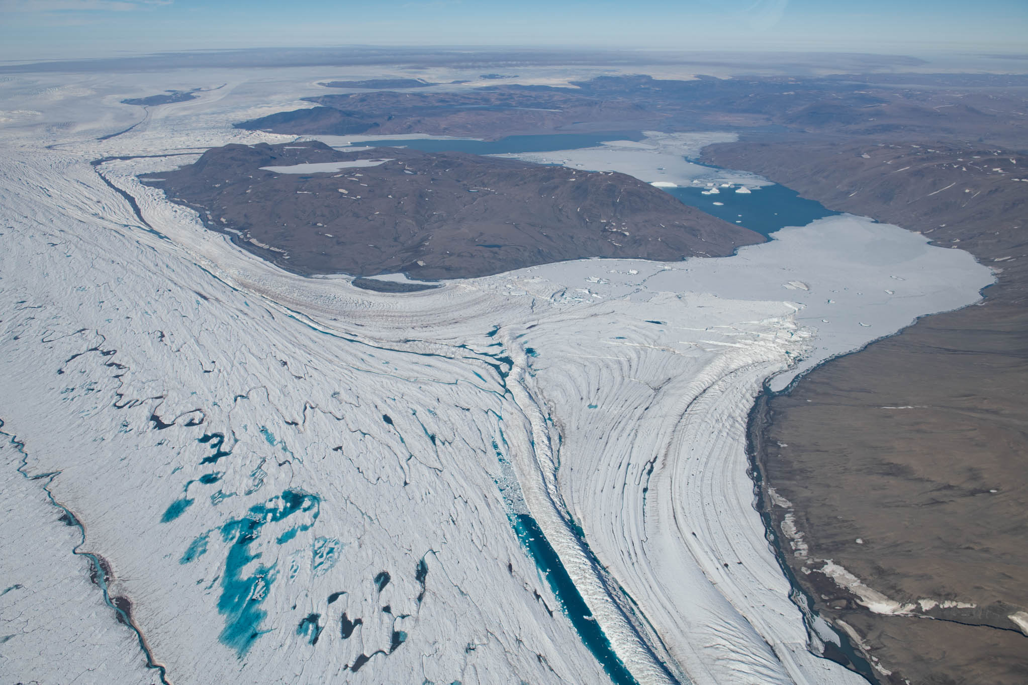
Changes in climate affect the mass balance of the Greenland Ice Sheet, causing it to expand, contract, thicken, thin, speed up or slow down in response to changes in surface melting, snowfall, iceberg calving, and submarine melting. Changes in the mass of the ice sheet have a direct effect on global sea level, so, understanding how the ice sheet’s previous extent relates to past variations in climate can provide us with crucial information about how the ice sheet will contribute to future sea level in response to predicted changes in Arctic climate.
Bombardment of exposed rock surfaces by cosmic rays can create various isotopes of key elements, which accumulate in the surface of the rock. Quantifying the relative amount of these isotopes can be used to establish how long a rock’s surface has been exposed to the atmosphere. Sufficient glacial erosion can remove the surface region where the isotopes accumulate, effectively re-setting the rock’s exposure clock to the time when the ice eroded it. This method of dating glacier behaviour, termed ‘cosmogenic isotope exposure dating’ has been used successfully across the globe to date the extent and thickness of former ice sheets and glaciers.
The region targeted during the expedition, Kronprins Christian Land, lies between the Northeast Greenland Ice Stream to the south, and Peary Land to the north. While both these regions have previously been targeted for exposure dating of glacier-eroded rocks (erratics and bedrock), Kronprins Christian Land has received relatively little attention. Prior to the expedition, the palaeoglaciology team, along with colleagues from the University of Sheffield, conducted some prospective geomorphological mapping from the 2m resolution ArcticDEM, to help target suitable field locations for rock sampling. By focussing their attention in this way, Adam and Andrew were able to collect 22 samples for cosmogenic isotope exposure dating. These samples will be combined with a few existing, yet undated samples to provide information about the timing of ice sheet recession and thinning in this little-studied, yet important region.


At the time that the limestones were deposited, in the Ordovician and Silurian, Greenland was located close to the equator and the rocks show many of the characteristics of tropical carbonate deposition, including traces of evaporite minerals such as gypsum. At 445 million years ago, in the latest Ordovician, a global glacial event caused rapid sea-level changes. The rocks across this interval were sampled by Paul Smith for micropalaeontology and stable isotopes to help constrain this event.


Besides visiting known cave sites, three new areas that turned out to be densely populated with caves were also explored. Many of the caves were ‘Greenland Classics’, a phrase that became a joke as the team scrambled, climbed, and thrutched their way into huge entrances that yielded passages less than 10m long. Several caves turned out to be promising though, and yielded tens of metres of cold, winding, ice-covered passages. As far as the GCP is aware, new records were set (breaking two previously held by GCP) for: (1) the longest cave in Greenland; and (2), the most northerly explored cave in the world (80.41301, -21.68294), though GCP hopes to break this record again in the coming years.


Written by Gina Moseley, Hazel Barton, Andrew Sole and Paul Smith